Before highways and GPS, brave explorers ventured into the unknown territories of the American West with nothing but basic tools and determination. These mapping expeditions transformed mysterious blank spaces on maps into detailed charts that guided settlers and shaped a nation. The courageous men who led these journeys faced incredible dangers while documenting mountains, rivers, and landscapes that Americans had never seen before.
1. Pike’s Southwestern Adventure
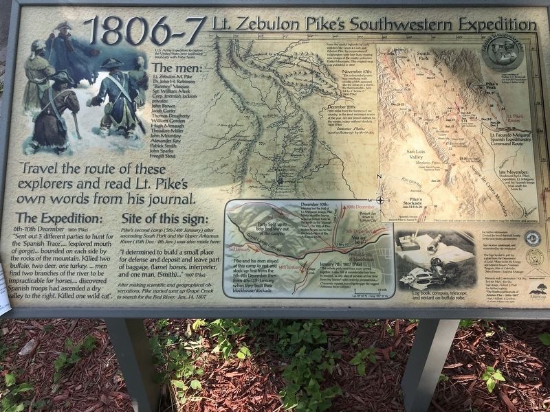
Young Lieutenant Zebulon Pike never intended to discover a famous mountain. In 1806, this ambitious 27-year-old army officer set out to map the southern reaches of the Louisiana Purchase, creating detailed records of territories nobody in the young United States had properly documented.
Struggling through brutal winter conditions with minimal supplies, Pike’s small team charted vast areas of Colorado, New Mexico, and parts of northern Mexico. His misadventures included being captured by Spanish authorities who suspected him of spying.
Though his expedition ended in temporary imprisonment, Pike’s maps revealed vital information about the Southwest’s geography and resources that would guide American expansion for decades.
2. Long’s Great American Desert

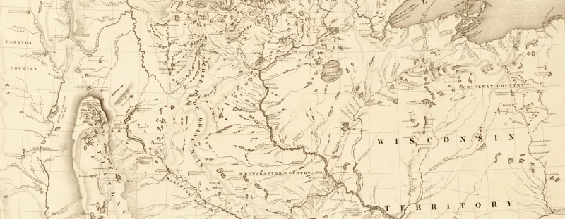
Major Stephen Long’s 1819 expedition team included something unprecedented – America’s first western landscape artist. While mapping the Great Plains and Rocky Mountain region, painter Samuel Seymour created visual records that complemented Long’s scientific observations.
Traversing what would become Nebraska, Kansas, and Colorado, Long’s team produced remarkably accurate topographical maps. However, his infamous labeling of the central plains as the “Great American Desert” discouraged settlement for years.
Despite this misjudgment, Long’s expedition collected invaluable botanical and zoological specimens. His detailed reports helped Americans understand the unique challenges and opportunities presented by the central territories during a critical period of westward expansion.
3. Frémont’s Path-Finding Missions
Nicknamed “The Pathfinder,” John C. Frémont transformed western exploration with his scientific approach to mapping. Between 1842 and 1844, he led multiple expeditions that produced astonishingly detailed maps of the Oregon Trail, Great Basin, and Sierra Nevada mountains.
Unlike earlier explorers, Frémont brought along professional cartographer Charles Preuss, whose precision revolutionized western mapmaking. Their published reports became bestsellers, captivating Americans with vivid descriptions of western landscapes.
Settlers heading west often carried Frémont’s maps as essential guides. His expeditions not only expanded geographic knowledge but also fueled the growing belief in Manifest Destiny that would reshape American history.
4. Powell’s Grand Canyon Odyssey
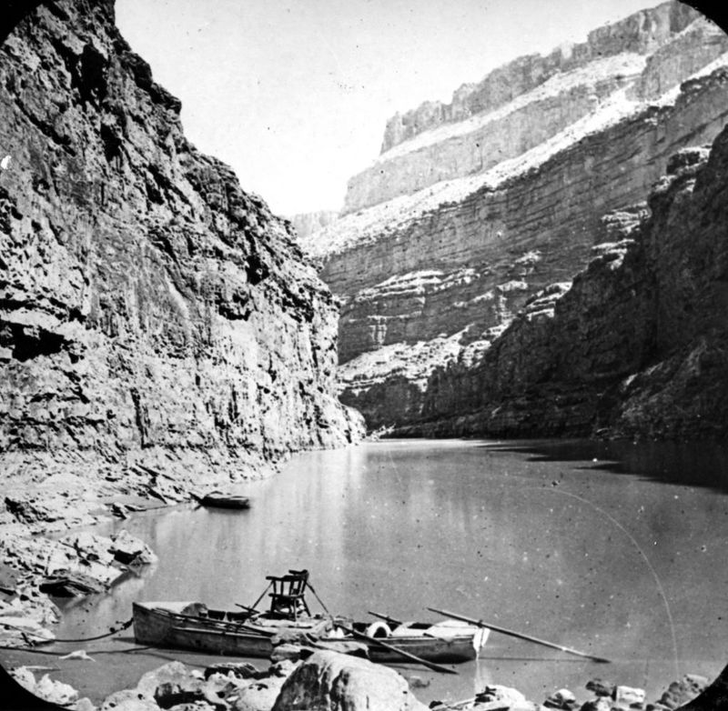
One-armed Civil War veteran John Wesley Powell accomplished what many thought impossible. In 1869, he led nine men in wooden boats down the raging Colorado River, becoming the first to navigate and map the Grand Canyon’s treacherous waters.
Armed with barometers and compasses, Powell’s team faced near-death experiences almost daily. They lost boats to violent rapids and survived on spoiled flour when supplies ran short. Three men abandoned the expedition, only to be killed by Native Americans.
Powell’s detailed geological observations and maps revealed the canyon’s true scale and complexity. His groundbreaking work fundamentally changed our understanding of the Southwest’s formation and established scientific approaches to water management still relevant today.
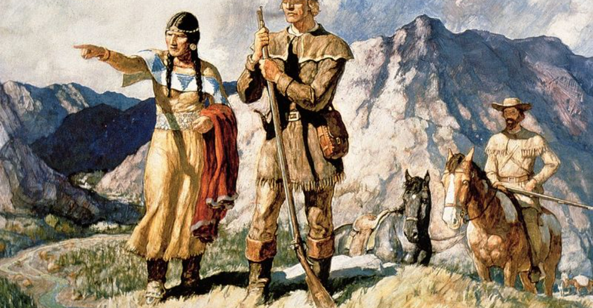
5. Lewis and Clark’s Corps of Discovery

President Jefferson’s bold gamble sent Meriwether Lewis and William Clark on an epic 8,000-mile journey across uncharted wilderness in 1804. Armed with notebooks and measuring tools, they meticulously documented hundreds of new plant and animal species while creating the first reliable maps of the Northwest.
Their expedition party, including the remarkable Shoshone guide Sacagawea, navigated treacherous mountain passes and raging rivers. Despite nearly starving in the Bitterroot Mountains, they persevered.
The maps and journals they produced opened America’s eyes to the vastness and potential of the continent, forever changing how Americans viewed their country’s future.
6. The Pacific Railroad Surveys

The most ambitious mapping project of its era wasn’t led by a single explorer but by five separate teams. From 1853 to 1855, the Pacific Railroad Surveys deployed hundreds of specialists to determine the best route for America’s first transcontinental railroad.
These teams collected unprecedented data across five potential routes from the Mississippi to the Pacific. Artists, scientists, and engineers documented everything from mountain passes to soil conditions, creating a treasure trove of information.
Their findings, published in twelve massive volumes with detailed maps and illustrations, represented the most comprehensive scientific assessment of the American West ever conducted. This monumental effort shaped not just the railroad’s path but America’s understanding of its western territories.